

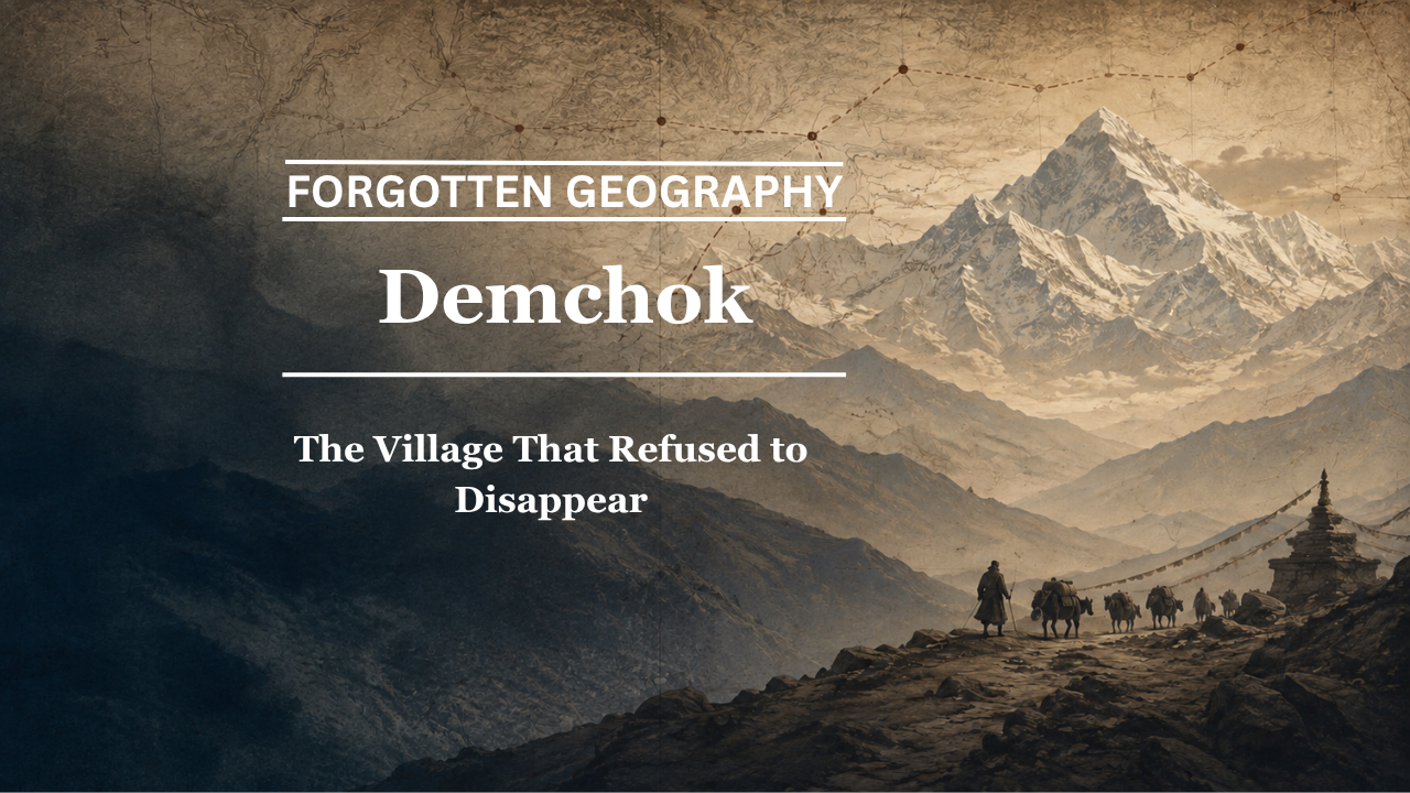
At a bend of the upper Indus, where Ladakh meets the Tibetan plateau, a tiny settlement survived for centuries because it stood on a road larger than itself — a road of trade, pilgrimage, pastoral movement and political memory.
By Pooja Bhatia
There are places whose importance comes from size, population or political power. Demchok belongs to another category entirely.
For much of its recorded history, it was little more than a small settlement beside the Indus. There were no great walls, no large market and no royal court. Yet the name appears again and again in chronicles, travel accounts, maps and boundary discussions because Demchok stood at a geographical threshold.
To the west lay Ladakh.
To the east stretched the plateau of western Tibet.
Along the Indus ran one of the natural corridors connecting the two.
Travellers heading towards Kailash and Manasarovar knew this landscape. Merchants knew it. Pastoral communities knew it. Surveyors eventually mapped it. And political authorities repeatedly referred to it because a place can be tiny and still occupy an extraordinarily important position.
Bharat Nanda, in Beyond the Himalayas: Rediscovering India’s Forgotten Geography, treats Demchok as one of the clearest surviving pieces of the older trans-Himalayan landscape. Unlike several names examined earlier in this series, Demchok does not require an attempt to reconstruct a lost Sanskrit equivalent. The name itself endured. What changed was the world around it.
That persistence makes Demchok unusual.
The village survived in memory even when the caravan world that gave it meaning began to disappear.
Where the Indus Becomes a Road
Demchok lies along the upper Indus, in a stark high-altitude landscape where the river provides one of the few obvious geographical lines through the mountains.
This matters.
Before modern roads, travellers in the Himalayas depended upon river valleys wherever terrain allowed. A valley could provide water, grazing and a recognisable direction through otherwise difficult country.
Demchok occupied such a location.
The settlement stood near the point where the Charding or Lhari stream joins the Indus. The combination of river, tributary and surrounding passes made the place easy to identify even though the settlement itself remained small.
The geography gave Demchok permanence.
A traveller did not need a city.
He needed a known point on the road.
A Name With Deep Historical Memory
Demchok appears in historical material connected with Ladakh centuries before the modern boundary dispute.
The 1961 Report of the Officials of the Governments of India and the People’s Republic of China on the Boundary Question, while presenting the respective governmental positions in a disputed context, reproduces material from older Ladakhi chronicles. In the Indian presentation, a tenth-century chronicle is cited as referring to Ldemchog-dkar-po, or Demchok Karpo, within the geographical description of Ladakh’s eastern frontier. (The Nehru Archive)
The same report also cites a later Ladakhi chronicle in connection with the conflict between Ladakh and Tibet in the seventeenth century. According to the Indian presentation of that source, the post-war settlement referred to the boundary at the Lha-ri stream at Demchok. (The Nehru Archive)
These historical references are important even when separated from the modern political claims built around them.
They establish that Demchok was not a recent cartographic invention.
The place had already acquired geographical significance in the political and cultural vocabulary of Ladakh and western Tibet centuries ago.
The Treaty of 1684
Demchok is closely associated with the aftermath of the Ladakh-Tibet war of 1679–1684.
The conflict ended with arrangements generally linked with the Treaty of Tingmosgang in 1684. Historical discussions of the agreement have long examined its implications for Ladakh’s relationship with Tibet, particularly in matters of trade, political authority and frontier practice.
During the India-China official discussions in 1960, the Indian side cited this seventeenth-century settlement and Ladakhi chronicles as historical evidence relating to Demchok. (The Nehru Archive)
For the purpose of forgotten geography, however, the deeper point is more interesting than the later legal argument.
Demchok appears because people on both sides knew the place.
A settlement had to be recognisable before it could serve as a geographical reference in political agreements.
Its significance therefore preceded the modern map.
A Village Divided by a Stream
Nineteenth- and early twentieth-century records portray Demchok as extraordinarily small.
Material later reproduced in the 1961 boundary report includes a 1904–05 account by a Ladakh official describing Demchok beside the Indus, where a nullah entered the river. The account referred to a handful of cultivators and huts on opposite sides of the stream. (Scribd)
The details are striking.
This was not a substantial town.
Its importance came entirely from where it stood.
A few houses beside a mountain stream could become a geographical marker because everyone travelling through the region understood the place.
This is a recurring pattern in the Himalayas.
Population tells only part of the story.
Location can matter far more.
The Road Towards Kailash
Demchok also belonged to a wider religious geography.
The upper Indus routes connected Ladakh with western Tibet, including the regions around Mount Kailash and Lake Manasarovar, among the most important pilgrimage landscapes in Asia.
Pilgrimage across the Himalayas followed practical geography.
Devotion did not eliminate the need for water, grazing or safe routes.
Pilgrims therefore often moved through the same corridors as traders.
The distinction between a commercial road and a sacred road could be surprisingly thin.
A caravan might carry wool and tea.
A pilgrim might carry offerings.
Both needed the same campsite.
Both waited for the same passes to open.
Both depended upon the same local guides.
Demchok occupied that shared landscape.
Nanda’s discussion in Beyond the Himalayas places the village within precisely this world: a historical corridor where trade, pilgrimage and local movement met along the upper Indus.
Minsar and the Pilgrimage Connection
The wider Ladakh–western Tibet relationship is also reflected in the history of Minsar, near the Kailash-Manasarovar region.
Minsar appears repeatedly in historical discussions because Ladakh maintained long-standing interests there connected with pilgrimage and religious endowments. During the India-China discussions of 1960, Indian officials referred to routes from Ladakh towards Minsar and to records in which Demchok appeared as an important geographical marker on that journey. (The Nehru Archive)
Whatever interpretation one places on the later political arguments, these references show that Demchok belonged to a recognised route system extending farther into western Tibet.
The village was part of a geographical chain.
Leh.
Rupshu.
Hanle.
Demchok.
Western Tibet.
Kailash.
The road mattered because the destinations mattered.
The Indus as Cultural Geography
The Indus is usually discussed as one of the great rivers of South Asian civilisation.
But its upper reaches tell another story.
Here the river was not yet the broad waterway familiar farther downstream. It ran through a high, cold and sparsely populated landscape.
Yet even here it organised movement.
Settlements clustered near water.
Pastoral routes approached its valley.
Travellers used the river as a geographical guide.
Demchok existed because the upper Indus made a difficult landscape more legible.
That relationship also explains why the settlement persisted.
Routes may shift.
States may change.
But rivers provide continuity.
Demchok in Early European Travel
European travellers entering western Tibet from Ladakh also recorded the region.
During the India-China boundary discussions, Indian officials cited the journey of the Jesuit Ippolito Desideri, who travelled from Leh towards Lhasa in 1715–16, as part of the historical evidence relating to the Ladakh-Tibet frontier. (The Nehru Archive)
Such travel narratives need to be used carefully, especially when later governments employ them in territorial arguments.
But as records of movement they remain valuable.
They demonstrate that the routes through eastern Ladakh and western Tibet were known to international travellers centuries ago.
The Himalayan frontier was difficult.
It was not sealed.
From Caravan Geography to Strategic Geography
Demchok’s meaning changed dramatically in the twentieth century.
The older landscape was defined by caravans, pastoral movement and pilgrimage.
The modern landscape became increasingly defined by international boundaries.
The same mountains remained.
The same Indus continued to flow.
The same small settlement retained its name.
But its function changed.
This transformation is one of the central themes of Beyond the Himalayas. Nanda repeatedly asks what happens when places once understood as corridors begin to be understood primarily as frontiers. Demchok offers perhaps the clearest example because the old name survived while the historical system around it faded.
Two Governments, Two Historical Arguments
Demchok later became part of the broader India-China boundary disagreement.
The official talks of 1960 are useful because they preserve the historical evidence each government chose to present. The Indian side cited Ladakhi chronicles, administrative reports, travellers and maps to support its position. The Chinese side disputed Indian interpretations and advanced its own historical and geographical case. The resulting report is therefore best read as a record of competing governmental arguments, not as a neutral historical verdict. (The Nehru Archive)
For this series, the dispute itself is not the central question.
The more fundamental historical point is uncontested:
Demchok possessed geographical importance long before twentieth-century diplomacy made it famous.
That older history deserves examination independently.
A Settlement Too Small to Vanish
There is something almost paradoxical about Demchok.
Larger cities have disappeared from maps.
Ancient capitals have become archaeological mounds.
Caravan towns have been abandoned.
Yet Demchok survives.
Why?
Because geography kept calling people back to the same place.
The Indus was there.
The tributary was there.
The route was there.
The surrounding mountain landscape forced travellers into a relatively limited number of workable corridors.
The village did not need to become large.
It needed only to remain useful.
The Meaning of the Name
The name Demchok itself belongs to the Tibetan Buddhist cultural world.
It is associated linguistically with Demchok, the Tibetan name connected with the tantric Buddhist deity Chakrasamvara.
This cultural vocabulary fits naturally within the religious landscape of Ladakh and western Tibet.
Yet the name should not be interpreted too mechanically.
A place bearing a Buddhist religious name does not necessarily indicate that it originated solely as a religious centre.
Names can arise from sacred geography, local tradition, monasteries, mountains or associations now lost.
What matters is that the name survived across centuries.
Unlike Bharuka, Gosthana or Agni-desa, Demchok did not need to be reconstructed from forgotten manuscripts.
People continued using it.
Geography Remembered Through Continuity
This makes Demchok different from many earlier subjects in the Forgotten Geography series.
The challenge here is not recovering a vanished name.
It is recovering the vanished meaning behind a surviving name.
Today Demchok is usually encountered in strategic reporting.
Historically, it belonged simultaneously to several worlds.
It was a river settlement.
A caravan halt.
A pastoral landscape.
A route marker.
A pilgrimage corridor.
A political reference point.
Those identities accumulated rather than replacing one another completely.
What Can Be Established
The historical record supports several conclusions without stretching the evidence.
Demchok is an old geographical name rather than a recent creation.
Ladakhi historical material cited in twentieth-century official records refers to the place centuries ago. (The Nehru Archive)
The settlement lay on the upper Indus and near a stream historically identified as Lhari.
Routes through the region connected Ladakh with western Tibet.
Demchok appears repeatedly in nineteenth- and early twentieth-century geographical and administrative records. (Scribd)
What these historical facts mean for modern boundary questions is a separate issue on which India and China have advanced differing positions. (The Nehru Archive)
Keeping those two questions separate is essential.
History can reconstruct how people used a landscape.
It cannot be reduced to a slogan about a modern dispute.
The Village That Refused to Disappear
The title of Bharat Nanda’s chapter captures something important.
Demchok endured.
Caravan trade declined.
Political systems changed.
Traditional routes lost their economic importance.
Modern roads altered travel.
The frontier became more regulated.
Yet the village remained on the map.
Perhaps this is because Demchok was never important in the conventional sense.
It did not depend upon an emperor.
It did not depend upon a particular trade commodity.
It did not depend upon a dynasty.
Its importance came from geography itself.
A river.
A stream.
A route.
A crossing point between landscapes.
As long as those remained, the name remained.
Modern maps remember Demchok principally as a frontier settlement.
Older geography remembers something broader.
It remembers travellers following the Indus.
It remembers pilgrims moving towards Kailash.
It remembers Ladakhi and Tibetan communities living on opposite sides of a small mountain stream.
It remembers a road through one of the highest inhabited landscapes on Earth.
Demchok survived because it was more than a village.
It was a point of connection.
And long before it became associated primarily with a boundary, it belonged to a world of movement.
That is forgotten geography.
Pooja Bhatia is a media analyst and law graduate with an interest in history and geopolitics.
